Emergency crews bracing for incoming storm bringing heavy rains and wind to Sonoma County
Emergency crews around Sonoma County are bracing for the return of heavy rain and wind to a sodden region that is still recovering from a string of atmospheric rivers in January and more recent rain and even snow.
It’s still hard to tell how severe the impacts will be from a new system, which is predicted to barrel in Thursday afternoon and deliver up to six inches of rain in the wettest areas, according to the National Weather Service.
Emergency personnel expect surface and stream flooding, at a minimum, with road closures, downed trees and power outages in typical areas.
“We’ve had rain pretty much every day,” with few breaks between, said Sonoma County Fire District Chief Mark Heine. “There’s no more room in the ground to absorb any more water.”
Firefighters, PG&E personnel, swift water rescue teams and road crews were expected to be staffed up and equipment pre-positioned near vulnerable areas so they can respond quickly to weather related problems, officials said.
First responders and public works crews know where to anticipate flooding, Heine said, including the Petaluma River and Mark West Creek, as it runs west from the Mayacamas Mountains, gathering strength across the Santa Rosa Plain, joined by Santa Rosa Creek and the Laguna de Santa Rosa — all collecting runoff that habitually spills onto low-lying roads.
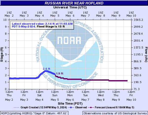
The Russian River, meanwhile, was forecast Wednesday afternoon to reach just above flood stage of 15 feet in Hopland beginning around 5 a.m. Friday, likely closing Highway 175 east of Highway 101.
In Guerneville, the river was forecast to crest Friday evening just above monitor stage of 29 feet before receding Saturday morning. Flood stage in Guerneville is 32 feet. There is significant margin of error in the forecasts.
It remained possible that the Thursday’s atmospheric river, already predicted to strike more directly on the Central Coast, will shift to the south, dropping less rain than anticipated on Sonoma County and its neighbors, Sonoma County Emergency Management Director Chris Godley said.
“Atmospheric rivers are significantly challenging to truly forecast in terms of rain and wind,” he said. “It’s going to hit the coast somewhere, for sure. But will it dive south again like it did in January?”
“We’ll know more tomorrow,” Godley said Wednesday.
The Category 2 atmospheric river is expected to bring most of its rain Thursday afternoon and evening, dumping 5 to six inches of rain in the coastal hills, 2½ to 3 inches or more in the valleys and 4½ to 5½ inches in the interior mountains by Friday night, National Weather Service meteorologist Brayden Murdock said.
Moderate rain was expected Friday, with scattered showers and periods of heavy rain Saturday before another storm system arrives late Saturday into Sunday, he said. More rain was expected again Monday and perhaps Wednesday, though longer range forecasting is less clear, Murdock said.
A flood watch will run from 1 p.m. Thursday afternoon to 10 a.m. Sunday, and a wind advisory will be in effect from 1 p.m. Thursday until 4 p.m. Friday.
Johannes Hoevertsz, Sonoma County director of public infrastructure, said county road crews had done little since late December but address storm damage and mitigation, like road sanding, clearing culverts, moving downed trees and plowing snow.
But he said they at least know where to expect flooding, and can be ready with the barricades — hoping people abide by closures and don’t take risks. It’s the unpredictable downed trees and other accidents that are challenging, he said. They are the unknowns.
In more northerly reaches, the storm is expected to bring a mix of rain and potential snow to upper elevations of Mendocino and Lake counties, depending on how cold shots of air mix with the tropical warmth of the atmospheric river, meteorologist Matthew Kidwell said from the National Weather Service’s Eureka office.
The storm is likely to start Thursday as rain, but later could either melt snow or add to it, depending on temperatures and specific locations, he said.
Residents should be aware of the possibility of rain adding excess weight to rooftops piled with snow, and the potential for collapse, he said. In other cases, snow berms on the sides of roads could lead to rivers of rain and melting snow down the middle.
A flood watch was to be in effect for Lake and Mendocino counties, he said.
Most of snowpack is outside the Russian River watershed, so concerns about melted snow contributing to flooding on the river were minimal, even though mountains around the Geysers got a dusting of new snow overnight Wednesday.
But with more rain on a saturated landscape, even a slight rise in the river above flood stage brings the water “right up to the backs of several homes and businesses,” Heine said.
He also noted that the river had reached the level at which it’s now forecast to crest when a woman who drove across floodwaters on Trenton-Healdsburg Road in Forestville died in the backed-up waters of Mark West Creek in January.
A young child also perished in the same series of storms after a tree blew over and into his family’s Occidental home.
Heine said residents should be prepared for similar conditions by having emergency supplies gathered and alternative power and light sources at the ready, omitting candles, which can be a hazard.
“We had huge impacts with the last atmospheric river events, and this is very much on track to be similar,” Heine said.
You can reach Staff Writer Mary Callahan (she/her) at 707-521-5249 or mary.callahan@pressdemocrat.com. On Twitter @MaryCallahanB.


UPDATED: Please read and follow our commenting policy: